Ohlone - Portolá Heritage Site
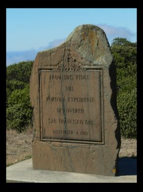
A rough granite monument marks the spot where Europeans first caught sight of the San Francisco Bay.
During the very first recorded in-land European exploration of what we now consider California, a Spanish expedition crested a ridge and beheld San Francisco Bay for the first time. While they did not see it for the hot bit of real estate it would become in the modern day, the site of the discovery is still marked with a large granite monument.
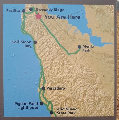
The Portolá Expedition, led by Spanish military man Gaspar de Portolá, was actually in search of Monterey Bay when they happened upon the scenic lookout that revealed (what would come to be known as) San Francisco Bay. The large expedition party had come up north from San Diego, trudging across the inland territory, not really sure how to find the bay they were looking for. On November 1st, 1769, a member of the expedition stumbled upon the large bay, viewing it from a spot on today’s Sweeney Ridge. He reported back to the rest of the group, correctly calling the bay an “estuary.”
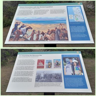
The expedition members were hungry, lost, and sick after six months journey. They were assisted by Native peoples along the way, and the local Ramaytush Ohlone people warmly greeted and fed them.
For millennia the Ohlone people followed seasonal rounds of hunting, fishing, and managing the land for their needs. In 1769, about 2,000 Ramaytush Ohlone people inhabited the San Francisco Peninsula, living in a network of ten independent tribes. The Aramai tribe, of modern-day Pacifica, accompanied the explorers to the top of Sweeney Ridge, where the Portolá party became the first Europeans to see San Francisco Bay. The Spanish “discovery” of San Francisco Bay would soon mean the loss of Ohlone lives, homelands and traditional ways when Spanish colonization started seven years later.
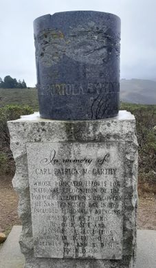
Today, the spot where the explorers first saw the bay is marked with a tall granite monument, and is protected as a National Historic Landmark #394. Of course the exact place where the expedition discovered the bay is not known, but the monument is placed in a likely spot. Good enough for government work, as they say.
Know Before You Go
On HWY 1 at Rockaway Beach, Pacifica, turn towards the hills on Fassler Ave. Follow Fassler Ave to its end.(about 2 miles)You will see the Trailhead Sign There. Park where convenient, respecting the neighborhood residents there, of course. This is the "BAQUIANO TRAIL" The sign says it is a mile to the site…I think it is more like 1.5 miles. The trail goes up and down, over the hills, it is well-marked and not too difficult. Layer your clothing. Be sure to take water and snacks as the weather will warm up fast once the trail gets above the fog! The view is fantastic! My photos don't even begin to show it! (Lots of great photos online)Anyone who calls the SF Bay Area home should visit this location at least once! Imagine, being part of that original expedition as you get closer and finally to the top of the ridge.
Appropriate footwear and clothing should be worn in this variable weather, due to its location along the coast. Dog walkers and off-road cyclists are known to use these trails.










Follow us on Twitter to get the latest on the world's hidden wonders.
Like us on Facebook to get the latest on the world's hidden wonders.
Follow us on Twitter Like us on Facebook